
Lymington roofers and builders
Roofing, brickwork and repointing, plastering and rendering, insulation, driveways and exterior cleaning across the High Street, Quay Hill, Captain's Row, Bath Road, King's Saltern Road, Waterford, Pennington and Buckland. One parish, two planning authorities, and the tide sets the risk rather than the weather.
The site visit is free and so is the written itemised quote. Thomas Hannen prices every job himself.
Lymington and Pennington
Two planning authorities, one parish
Lymington town centre is not in the New Forest National Park. Just over seven square kilometres of the same parish is. That single line decides who reads your application, which local plan it is read against, and how long the answer takes. It is the first thing we establish about a Lymington address, before we talk about tiles.
New Forest District Council is the planning authority for the town centre, the High Street, Captain's Row, Bath Road, Upper Pennington and Gordleton. The New Forest National Park Authority is the planning authority for the coastal area south of Lymington and Pennington, for Pennington Common and for the area around Buckland. Point checks put Buckland Rings, Ampress, the Lymington River north of the town, Pennington Marshes and Normandy inside the Park boundary.
The New Forest was designated a national park on 24 January 2002 and confirmed on 1 March 2005. The Authority became the sole local planning authority for its area on 1 April 2006, under the order made in 2005. Sole means what it says: inside that boundary the district council is not the decision maker.
| Where the property is | Who decides | What else applies there |
|---|---|---|
| Town centre, High Street, Captain's Row, Bath Road | New Forest District Council | Lymington and King's Saltern conservation areas, and an Article 4 Direction on some streets |
| Upper Pennington, Gordleton | New Forest District Council | Outside the Park, outside the town conservation areas |
| Coast south of Lymington and Pennington, Pennington Common, Buckland | New Forest National Park Authority | Buckland conservation area, which straddles the boundary with the district |
| Buckland Rings, Ampress, the river north of town, Pennington Marshes, Normandy | New Forest National Park Authority | Point checked as inside the Park boundary |
Be careful what the boundary does not do. It does not follow the postcode: SO41 sits wholly in the New Forest district but spans both authorities, taking in Beaulieu, Boldre, Brockenhurst, East Boldre and Sway. It does not change whether a building is listed, because listing is national. And it is not the only designation in play, because Green Belt washes over the parish outside the settlement boundary whichever authority you are dealing with.
March 2026
The design guide that stopped being a suggestion
The neighbourhood plan was made on 26 March 2026, and it gave the Lymington Local Distinctiveness supplementary planning document full development plan weight. Before that, the guidance was a material consideration. Now it forms part of the development plan, which is a different thing in law, and design objections land harder here as a result.
The referendum was held on 29 January 2026 and passed with 92.5 per cent in favour, 1,992 votes to 162, on a turnout of 17.1 per cent. The plan was made and the weight followed.
That changes the calculation on substitution. A plastic window, an oversized dormer or a concrete tile on a clay tile street is no longer just something a conservation officer dislikes. It is something the plan itself speaks to. So we price the matched option first and show you what it costs against the substitute, rather than letting you find out at appeal.
Designations
Three conservation areas, two authorities
Most towns this size have one. Lymington parish has three, and two authorities run them.
The Lymington conservation area was first designated in July 1977 and amended in 1988, 1992 and 1999, with the current boundary dating from 1 December 1999. It is a district council area and it contains over 270 listed structures. King's Saltern conservation area followed in April 2001, also district. Buckland conservation area dates from 1 December 1999 and is a National Park Authority area, described as straddling the boundary with the district. For scale, the district has 22 conservation areas in total.
Then there is the trap. The national planning dataset shows only one Article 4 Direction for this area, the 1971 direction covering hovercraft in the Solent, which has nothing to do with your roof. The district council's own conservation area appraisal confirms a separate direction restricting permitted development on unlisted dwellings at Southampton Road, Captain's Row, Station Street, Gosport Street, Bath Road, Belmore Lane, New Street, Quay Road and Priestlands Place. Checking the online map alone misleads.
We could not verify a date for that direction, so we are not going to invent one. We ask the authority about your address instead of assuming permitted development covers a window, a roof covering or a hard surface.
Roof coverings
Tile on the older roofs, slate on the later streets
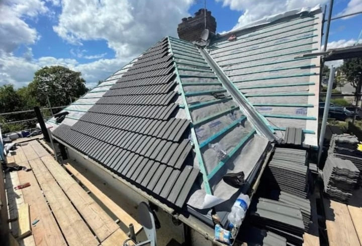
The conservation area appraisal is short about it: "roofing materials are, predictably, clay tile or slate", and which one belongs on your roof is mostly a question of when your street was built. That is a better starting point than looking at the neighbours, because the neighbours may already have got it wrong.
The appraisal sets out the rule of thumb. Tile is more likely on older buildings, on buildings with steeper roof pitches and on the more humble type of dwelling. Slate is more usual on houses in streets developed at a later date, and it names Gosport Street and Southampton Road as examples. It goes further for the centre: clay tile is clearly the more appropriate roofing material in most parts of the town centre.
Three things the appraisal tells you before anyone climbs a ladder
- The rear wing may want a different material to the front. There tends to be a greater use of slate in those positions, because those parts are often later and may have shallower pitches. One property can legitimately be tile at the front and slate at the back.
- Only natural roofing materials should be used. Whether the covering is tile or slate, that is the stated position. It rules out the fibre cement and reconstituted options that get offered as a like for like on the phone.
- Dormers here have a shape. Most are hipped, with a clay-tiled roof covering and tile-hung cheeks, and they are modest in size. A flat-roofed box dormer with plastic cheeks is not a repair of what is there, it is a replacement of it.
One local quirk affects when you find out about a problem. Parapets on the High Street and St Thomas's Street conceal the lower roof from street level, so a failing covering behind one is invisible from the pavement. That slope wants looking at on a schedule rather than when a ceiling stains, and our roofing services page explains how we survey and photograph it.
Brickwork
Plum in the brick, chequerboard in the wall
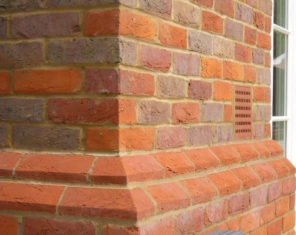
The typical Lymington brick is described as a strong simple stock brick with a plum coloured element in it, warm red with orange tones. Get a sample wrong here and it reads as a patch from across the street for the next fifty years.
Overfired grey and blue headers give some elevations a chequerboard, and the appraisal points at Stanford Road and at 15 and 16 Captain's Row. That pattern is made by the bond and by the burn, not by a decorative course, so a repair that ignores the header colour breaks the pattern even when the mortar is perfect.
The appraisal is blunt on paint: unpainted buildings in the old Lymington stock brickwork should not be painted. Roughly three to four in ten of the painted buildings are rendered underneath anyway, so a painted neighbour is no evidence that painting brick is local habit.
Two things also behave differently to how they look. Wistaria House on St Thomas's Street has mathematical tiles, often confused with yellow bricks: a hung finish on a frame, not masonry, repaired as a hung finish. And the crinkle-crankle boundary walls on the back lanes are serpentine on purpose, because the curve is what holds them up. Both are brickwork and repointing jobs, not general building.
Access and layout
Burgage plots, back lanes and rear wings
Lymington's medieval burgage plots survive, complete with the cross lanes and back lanes that served them, and that governs how we get to your roof. Madeira Walk and The Tins are the obvious survivors. On a long thin plot the back of the building is reached from a lane, not from the frontage, and the lane decides the scaffold.
Most buildings in the town centre have one or more rear wings. That is the plot form showing through: build deep, not wide. The roof you are paying for is often several geometries rather than one, with valleys, changes of pitch and a covering that may switch material between the front slope and the wing. The interesting failures are round the back where nobody looks.
So a Lymington quote has to include a route in. Where the lane is too tight for a wagon we hand materials in, and that is a real cost we would rather show you than bury. Where the lane serves several plots, the neighbours need telling before the scaffold arrives.
One last thing about age. Almost nothing pre-eighteenth-century is visible here, but that is about casings rather than dates. Seventeenth-century cores sit behind later fronts, and 26 and 27 High Street concealed a very late fifteenth-century house. So we open up carefully and stop to tell you when what we find is older than the quote assumed.
Water, part one
Tidal risk, not river risk
Flood risk in Lymington is tidal, and it changes over a short walk. The Environment Agency's tidal models put Lymington Quay, King's Saltern Road and Pennington Marshes in Flood Zone 3. Lymington Town station and Waterford sit in Zone 1. Two addresses a few minutes apart can sit either side of that line.
The estuary edge is not what it was. The King's Saltern appraisal records that the edge of the river has since receded and been formalised with a hard edge. Behind it lie the historic saltpans, the largest in Hampshire, and at the mouth the Hurst Spit stabilisation scheme was carried out in 1996.
The British Geological Survey's coastal assessment for Lymington records the profile hazard as very low and the risk as low. That is a useful counterweight to the way this coast gets talked about, and we would rather quote it than trade on alarm.
We could not verify a single dated Lymington tidal flood event to a source we would stand behind, so we are not going to repeat one at you. The same goes for the salt marsh loss figures that get quoted locally. If a fact does not check out, it does not belong here.
Water, part two
Perched water above impermeable beds
The British Geological Survey records that impermeable Headon Beds underlie much of the gravel here, giving rise to perched water tables, and that the gravel is usually wet at the base except where the deposits are very thin. That one sentence explains most of the drainage arguments in this town.
A soakaway that drains beautifully in a trial hole in August can back up in February, because it sits on the wet base of a deposit with nowhere to send water. Here an infiltration test is a season question, not a day question. (The older mapping called that deposit Plateau Gravel. The current term is River Terrace Deposits, and you will see both.)
Underneath, the Headon Hill Formation of the Solent Group covers around two thirds of the town and all of Pennington: interbedded clay, silt and sand units with several limestone and lignite beds. Becton and Chama Sand of the Barton Group takes the northern third. On the surface, River Terrace Deposits cover about half the town and tidal flat clay and silt about an eighth, around the estuary, quay and marshes.
Interbedded is the word to notice. That is not a uniform bearing stratum, so a wall footing or a patio sub-base can meet two materials inside one trench. Near the water the tidal flat ground is soft, and the district's own description places the edge of it: land rises quite steeply and uniformly for 250 to 350 metres away from the riverside alluvial deposits.
What we do in Lymington
What Lymington asks for first
Ordered by what the fabric asks for. The covering is under a natural materials rule, so roofing leads, then the stock brickwork it sits on, then the walls behind, and the ground last because here it is decided by water rather than taste.
Roofing
Matched clay tile and natural slate, leadwork, valleys and the rear-wing geometry that comes with a burgage plot. Hipped dormers with tile-hung cheeks repaired as dormers rather than replaced with boxes. Parapeted frontages surveyed from above, because the street view tells you nothing about the slope behind.
Roof repair and replacementBricklaying and repointing
Plum-toned stock brick, chequerboard elevations made by overfired headers, mathematical tiles that are not brick at all, and serpentine boundary walls on the back lanes. Lime mortar, hand raking and a matched joint, and no painting of unpainted historic stock brickwork.
Repointing and masonry repairPlastering, rendering and insulation
The heating data says this matters more here than in a mains gas suburb. Across this statistical area only 58.6 per cent of households are on mains gas, with 9.9 per cent on oil alone and 3.0 per cent on tank or bottled. That covers the rural hinterland too, and Pennington on its own is 79.7 per cent gas, so the off-grid share sits at the edges. Where heat is expensive, loft and wall work pays back faster.
Plastering and renderingDriveways and patios
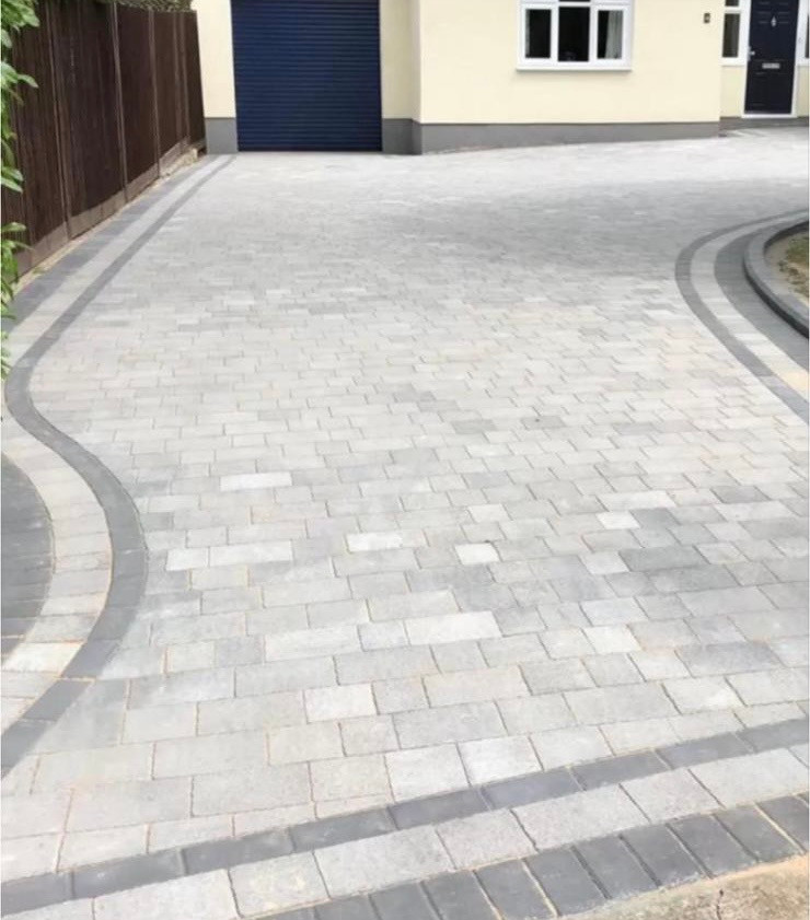
Last on the list and first to go wrong if the drainage is guessed. Perched water sets the soakaway design, soft ground near the quay sets the sub-base, and around Quay Hill, Quay Street and Church Lane the surface itself may be protected.
Loft and wall insulationThe housing mix shapes who we end up talking to. Of the 4,074 households here, 41.0 per cent are detached and 22.1 per cent semi-detached, 16.8 per cent are flats, and another 2.3 per cent are homes inside a commercial building, which is the flat over the shop. On a High Street flat the roof belongs to the building rather than to you, so the first job is working out who has to agree. We also handle roof, render and patio cleaning, gently on historic brick, because pressure takes the face off soft stock brick and it does not grow back. Finished work is on our recent projects page.
Questions
Questions we get from Lymington and Pennington
Is Lymington in the New Forest National Park?
No, and the exact answer matters. Lymington town centre sits with New Forest District Council, along with the High Street, Captain's Row, Bath Road, Upper Pennington and Gordleton. Just over seven square kilometres of the same parish is inside the New Forest National Park, including Buckland Rings, Ampress, the Lymington River north of the town, Pennington Marshes and Normandy. The Authority has been the sole planning authority there since 1 April 2006.
Is there an Article 4 Direction on my street?
Checking the national map alone will mislead you. The only Article 4 Direction in the national dataset for this area is the 1971 direction covering hovercraft in the Solent. New Forest District Council's own conservation area appraisal confirms a separate direction restricting permitted development on unlisted dwellings at Southampton Road, Captain's Row, Station Street, Gosport Street, Bath Road, Belmore Lane, New Street, Quay Road and Priestlands Place. The appraisal also states PVCu is not supported on buildings subject to one.
Should my roof be clay tile or slate?
Ask when your street was built. The conservation area appraisal gives a rule of thumb: tile is more likely on older buildings, on steeper pitches and on the more humble type of dwelling, while slate is more usual in streets developed at a later date, such as Gosport Street and Southampton Road. Rear wings tend to use more slate because they are often later and shallower. Whichever it is, only natural roofing materials should be used.
Can I relay the cobbles outside my house on Quay Hill?
Treat it as work on a listed surface, not as a paving job. The cobbled surfaces at Quay Hill and Quay Street are listed in their own right, and the pavements on Church Lane are worn Purbeck stone flags. Lifting, relaying or replacing any of that needs consent before a tool touches it, and the honest answer is usually repair in kind rather than a new surface.
How much should I worry about flooding near the quay?
The risk here is tidal rather than fluvial, and it changes over a short walk. Environment Agency mapping puts Lymington Quay, King's Saltern Road and Pennington Marshes in Flood Zone 3 under its tidal models, while Lymington Town station and Waterford sit in Zone 1. The British Geological Survey's coastal assessment for Lymington records the profile hazard as very low and the risk as low.
Lymington is a fair way from Bournemouth. Will you actually come out?
Yes, and we will say plainly that Lymington is 14.2 miles from us, the furthest point of the area we cover. That means we book a site visit at a set time rather than dropping in, and we try to see more than one Lymington job on the same run. The visit and the quote cost nothing, and you get the quote in writing after we have been on site.
We cover Lymington and Pennington and the addresses around them: the High Street, St Thomas's Street, Quay Hill, Nelson Place, Gosport Street, Belmore Lane, New Street, Station Street, Priestlands Place, Stanford Road, Church Lane, Madeira Walk, The Tins, Waterford, Lower and Upper Pennington, Pennington Common, Gordleton, Buckland, Buckland Rings, Ampress and Normandy. The SO41 outcode sits entirely within the New Forest district in Hampshire, but it reaches out to Beaulieu, Boldre, Brockenhurst, East Boldre and Sway and crosses between two planning authorities on the way. The postcode alone will not tell you who decides your application. Tell us the street and we will work it out before we quote.
Trade by trade
Each trade, written for Lymington
The same local evidence, read through each trade in turn. Ground conditions decide a driveway, exposure decides a roof, and the age of the housing decides insulation.
- Roofing in Lymington
- Flat roofing in Lymington
- Bricklaying and repointing in Lymington
- Repointing in Lymington
- Driveways and patios in Lymington
- Patios in Lymington
- Plastering and rendering in Lymington
- Rendering in Lymington
- Insulation in Lymington
- Loft insulation in Lymington
- Wall insulation in Lymington
- Exterior cleaning in Lymington
- Gutter cleaning in Lymington
- Fascias, soffits and guttering in Lymington
Who you are dealing with
A local firm you can check
Lymington and Pennington are the far edge of our patch at 14.2 miles, so we book the site visit at a set time rather than dropping in, and we work the SO41 addresses out towards Boldre, Brockenhurst and Sway.
You are dealing with Bournemouth Roofing & Building, the trading name of Bournemouth Roofing & Building Ltd, registered in England and Wales, company number 15471719. That takes a minute to check. Thomas Hannen owns the firm and he prices every job himself, so the person who quotes it is the person answerable for it. One multi-trade team does the work, and none of it is sub-contracted out to somebody you have never met.
There is a verified customer's 10 out of 10 on our Checkatrade profile. The site visit is free and so is the written itemised quote. The phone is answered 24 hours for emergencies, and scheduled work runs Monday to Friday, 8am to 6pm.
Free quote
A written price for your Lymington address
Give us the street and what it is doing. Say if it is listed, in a conservation area, or the far side of the National Park boundary, and we will price the matched option properly.