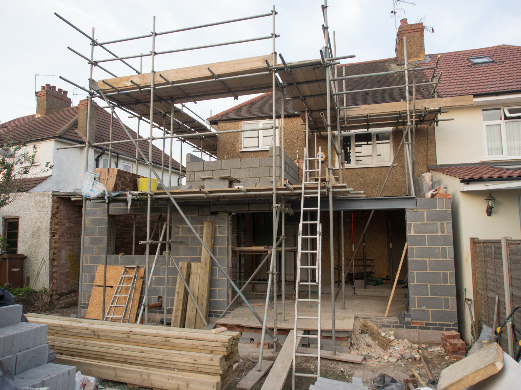
West Moors roofers and builders
Roofing, brickwork and repointing, plastering, rendering and insulation, driveways and exterior cleaning across West Moors, from Station Road and Glenwood Road to Riverside Road, Mannington Way and the Uddens Water. A flat, sandy bungalow village with no conservation area, and a river running through the middle of it.
The site visit is free and so is the written itemised quote. Thomas Hannen prices every job himself.
West Moors
No conservation area, and no landscape designation either
West Moors has no conservation area at all, and the council put that in writing. The Christchurch and East Dorset Core Strategy, adopted in April 2014, says under West Moors Built Character: "West Moors is a relatively recent settlement and does not have a conservation area. There are some parts of the urban area that have been designated as Special Character Areas." The same document adds that "there are no landscape designations within the Parish."
That absence is the most useful planning fact about the village, and almost nobody leads with it.
East Dorset mapped all nineteen of its conservation areas in 2007, from Pentridge and Cranborne down to Sturminster Marshall, Wimborne Minster and West Parley. Not one is in West Moors.
So most exterior work here runs under ordinary householder permitted development rights rather than conservation area consent: no area-wide control over roof coverings, no six-week tree notification, no blanket restriction on rainwater goods or window materials. Tree preservation orders still apply where they exist, listed building consent still applies to any listed property, and the heathland rules below apply regardless.
Two caveats. The two Special Character Areas do carry design guidance, covered below, and permitted development rights are removed on some newer estates by planning condition rather than designation. We are roofers and builders, not planning consultants, so confirm your address with Dorset Council first.
Ground
Sand over river gravel, and a water table close behind it
The ground under almost all of West Moors is the Branksome Sand Formation, sand, with river terrace sand and gravel laid over much of it. We checked the British Geological Survey 1:50,000 mapping at ten points. Station Road, Church Road, Compton Crescent, Pinehurst Road, Moorlands Road, Glenwood Road and West Moors Plantation all sit on Branksome Sand, with River Terrace Deposits 3 over parts of it.
The exceptions are at the low end. Fryer's Field is Parkstone Clay Member, clay. Shaftesbury Road, running south-west towards the Uddens Water, is Poole Formation under alluvium, the softest ground here. Riverside Road is Poole Formation under River Terrace Deposits 2. The Slop Bog and Uddens Heath citation sums the setting up: "These heathland areas on Bagshot Sands and Valley Gravels are situated in the valley of the Uddens Water, a tributary of the Moors River."
Free-draining ground, but a shallow water table
Sand and gravel take water readily, so a soakaway in ground that will not accept water is not the West Moors problem. The constraint runs the other way. The village is flat and low: median height around 19 metres above sea level, range roughly 14 to 29, about 15 metres of relief across the whole settlement. Riverside Road and the Uddens Water sit at 14 to 16 metres, Station Road about 20, Moorlands Road 21 to 22.
So the ground drains, then meets water rising from below. In a wet winter a soakaway pit or a footing trench at the lower end of the village can find groundwater before it reaches the depth on the drawing, and saturated sand will not stand up in an unsupported trench.
Wet winters
Groundwater in the sewers, not just in the ground
Wessex Water names West Moors in its Regional Infiltration Reduction Plan, with 13,793 metres of sewer surveyed by CCTV and 200 metres of sewer sealed across 2018/19 to 2023/24. The scheme is listed as Palmersford, covering Woolsbridge and West Moors The Forest: a named, dated programme of work on the sewers under this village.
The company describes the mechanism plainly: "During prolonged wet periods groundwater levels rise above our public sewers. Any cracks or holes in the sewer system can allow the groundwater to infiltrate and can inundate the sewers. This can cause sewer flooding and restricted toilet use which can continue for many weeks during very wet winters."
The storm overflow monitoring shows the same thing. The recorded cause of spill at the West Moors Pennington Copse overflow is groundwater, discharging to a tributary of the Uddens Water. Not rainfall.
Two things follow for building work. Anything dug below ground between roughly November and March is working in a system that is already full. And Wessex Water will not take rainwater into a foul or combined sewer for a job of any size, so a new roof, extension or hard surface needs its own answer for surface water.
The Uddens Water
A river through the village, and defences built to a two-year standard
3.41 per cent of the built-up area of West Moors is in Flood Zone 3 and 5.39 per cent in Flood Zone 2, and 544 metres of Environment Agency designated Main River runs inside the built-up area itself. Flood Zone 1 covers the other 94.6 per cent. The Core Strategy states it without ceremony: "The Moors River and Uddens Water flow through the Parish and on occasion cause flooding."
The River Crane rises near Cranborne, flows south and becomes the Moors River below Moors Valley Country Park, and the Uddens Water is a tributary of it. Dorset's Level 1 Strategic Flood Risk Assessment names the streets: "In West Moors, the Flood Zones encroach on some residential areas along Riverside Road and Mannington Way." There is Flood Zone 3 land at Shaftesbury Road too.
The dated event is Christmas Day. The assessment records "Riverside Road, West Moors, 25/12/2013, channel capacity exceeded (no raised defences)." The Agency's recorded outlines confirm it independently, two overlapping the built-up area, beginning 24 and 25 December 2013. Dorset's technical report logs nine reports that winter: four of internal property flooding and five external.
| Item | Recorded position | What it means for you |
|---|---|---|
| Flood Zone 3 | 3.41% of the built-up area | Most of the village is not in it. A minority genuinely is |
| Main River | 544 m inside the built-up area | Work near the bank can need Agency permission as well as planning |
| Defences | Embankment, high ground and wall, condition graded 2 to 3 | Unusual around here, and not a high standard |
| Standard of protection | 1 in 2 years | A very low bar, not a guard against a serious flood |
| Formal investigation | No Section 19 report exists for West Moors | The Gladelands study of December 2013 covers Ferndown, not here |
West Moors has real flood defences, with 33 Environment Agency asset records within 500 metres. But the recorded standard of protection is one in two years, close to the bottom of the scale. Anyone telling you the village is defended has told you something true and something misleading in the same breath.
Housing stock
Bungalow country: over 45 per cent of the dwellings
Over 45 per cent of dwellings in West Moors are bungalows, and 59 per cent of homes are owned outright with no mortgage. Those figures come from the West Moors housing section of the Core Strategy and the East Dorset local plan evidence behind it, which also records that only just over 10 per cent of dwellings are rented, of which only 3.5 per cent are private, and that 41 per cent are considered under-occupied.
Bungalows are close to half the housing here, and they change the arithmetic of a roof.
A single-storey house carries far more roof per square metre of living space. The same floor area is spread across one plan instead of two, so covering, underlay, battens, ridge, hips and verges all roughly double against the accommodation underneath. A re-roof on a bungalow costs more per bedroom than on a two-storey house.
Two things push back the other way. Access is low and simple, so scaffolding is cheaper and quicker to strike, and much eaves-level work needs no full tower. And because the roof is such a large share of the external envelope, loft insulation returns more here than almost anywhere. On a bungalow, the roof is the heat loss. You can read how we approach it on the loft and cavity insulation page.
The population profile fits the stock: about 7,400 people, more than 40 per cent over 60 and only 14 per cent under 15, with the 2011 census recording 7,561 for the parish. With most owners holding outright there is no lender and no landlord in the decision, and in our experience people want the repair option costed honestly alongside the replacement.
How it got here
Built by a fuel depot, not by the railway
West Moors had a railway junction from 1867, but it was the military fuel depot that built the modern village. The station opened where the Southampton and Dorchester Railway, Castleman's Corkscrew, met the new Salisbury and Dorset Junction Railway. Passenger services ended on 4 May 1964. The line then stayed open purely as freight to the Royal Army Ordnance Corps fuel depot until 1974, when the rails came up.
Almost none of it survives. The station site is a housing estate now. What is left is the original level crossing gatekeeper's cottage on Station Road and the Castleman Trailway on the trackbed.
The growth came from the other direction. The village expanded with the military fuel depot built outside the settlement but inside the civil parish, home to the Defence School of Petroleum and to the Dorset and Wiltshire Fire and Rescue Service Training Centre. RAF fuels training moved here from RAF Halton in April 2017. Then, under project Wellsley, the RAF moved on to MoD Worthy Down in January 2019 and the Army by April 2020, ending more than eighty years of military presence. Most jobs there are civilian now, and the military housing has been sold off.
Why that matters when we quote
It leaves a distinct layer in the housing stock. A village that grows house by house fails house by house. A village that gained whole estates of married quarters, built to one specification and later sold into private hands, has a cohort of properties reaching the same maintenance point together. That is our own reading rather than anything a council document says, but it holds up: where one roof on a run has lost its mortar bedding at the ridge, the neighbours are usually a season behind.
The depot and the Gundrymoor industrial estate are still the main employment here, and the centre is small and defined at 44 units with a secondary parade to the east. In the old East Dorset local plan that was the district's single designated district centre.
Riverside Road and Glenwood Road
Two special character areas where there is no conservation area
The two Special Character Areas are where design guidance still bites, and the Riverside Road one is unlike anything else we work in. East Dorset published them in October 2005. Riverside Road is a small, single-street character area of mostly 1950s bungalows, each in a large plot, fronting a straight, un-mettled road. The appraisal says the gravelled surface, grass verges and almost continuous frontage hedges give the road a distinctively informal character, with open countryside by the Uddens Water at the western end.
The rules matter if you are thinking about a driveway. Frontage hedging is not to be replaced with fences or walls. Large expanses of hard standing are to be avoided. Existing wide frontages with relatively few vehicular entrances are to remain. So the default suburban answer, rip out the hedge, drop the kerb and pave the frontage, is wrong here, and wrong on drainage grounds too: Flood Zone 2 and 3 land sits within 100 metres, and this is the one street in the village with a dated fluvial flood record.
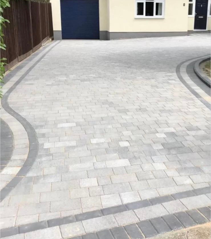
What works instead is a narrow entrance on the existing crossing point, a permeable or gravel-retained surface that reads with the unmade road, and the hedge kept and gapped rather than removed. We cover how those are built on the driveway and patio page.
The other one, Glenwood Road and Moorlands Road, is a different animal: mostly pre-First World War family houses in large sylvan plots, two-storey villas of consistent scale and detailing, with Moorside Road distinguished by larger gardens and a number of Arts and Crafts buildings of special architectural interest. New work there is asked for in render, orange-red facing brick and natural slate or plain tile roofs, and the frontage hedges are expected to be evergreen and often above eye level.
The edges
A conifer plantation on one side, heathland on most of the others
West Moors has a working conifer plantation on its north-western edge. Dorset Council's East Dorset and Purbeck Landscape and Heritage Study, published in January 2021, refers to the wooded backdrop of the West Moors Plantation seen along Compton Crescent, and identifies it as a Site of Nature Conservation Interest north-west of the settlement edge.
Around the rest of it is heath. Within about a kilometre are Holt and West Moors Heaths, 766.25 hectares, notified to the Secretary of State on 10 July 1988 with a substantial part also a National Nature Reserve, and Slop Bog and Uddens Heath, 43.5 hectares, notified in 1985. Within about two kilometres are the Moors River System at 293.05 hectares and Parley Common at 164.1 hectares, and the Moors River System designation overlaps the built-up area itself by roughly a quarter of a hectare. As the Core Strategy puts it, there are internationally protected heathlands in the parish, some of which adjoin the urban area.
What the trees mean for maintenance
The Slop Bog citation records heathland colonised by bracken or by Scots pine. No council or agency document we have found discusses what conifers do to gutters, so treat what follows as our own professional observation rather than sourced fact. On a plot backing onto pine, gutters and valleys silt up faster than on an open estate, and the debris is fine rather than leafy, so it packs down and holds water instead of washing through. On a bungalow that is easier to deal with, because you can reach it, but the interval between clears is shorter. Our approach to roof, render and gutter cleaning is on its own page.
Two rules worth knowing, and one that does not apply
- The heathland distance rule. The Dorset Heathlands Planning Framework, adopted by Dorset Council and BCP Council on 31 March 2020, bars residential development within 400 metres of protected heathland and requires mitigation between 400 metres and five kilometres. It bites on net new dwellings, so ask the council how it applies to yours.
- Surface water has no approving authority. There are no Critical Drainage Areas anywhere in Dorset and Schedule 3 of the Flood and Water Management Act 2010 is not in force. The practical control is Wessex Water's refusal to take rainwater into a foul or combined sewer.
- Nutrient neutrality does not apply here. West Moors sits outside every Natural England nutrient neutrality catchment: the Moors River drains to the Stour, and the Stour is not designated for it. That is one hurdle you do not have.
What we do in West Moors
The trades this village needs, in the order it needs them
Roofing leads because when nearly half the housing is single storey, the roof is the largest surface on the house.
Roofing
Bungalow roofs mostly, with the long low runs of ridge, hip and verge that come with them, plus estate stock where the covering is sound and the mortar and underlay are not. Dry ridge, dry verge, eaves and flashing repairs are the common jobs, and with no conservation area the covering choice is yours on most addresses.
Roofing servicesInsulation, plastering and rendering
Second because of the same arithmetic. On a single-storey house a bigger share of the heat goes out through the roof than the walls, so loft work returns more here. Render repair matters on the flat, exposed frontages, and around Glenwood Road render is one of the finishes the character area guidance names.
Plastering and renderingDriveways and patios
Sand and gravel subgrade usually takes infiltration well, which makes a permeable build genuinely workable, but the water table at the low end of the village limits how deep a soakaway can usefully go. On Riverside Road the design starts from the hedge, not the paving.
Drives, paths and patiosBricklaying and repointing
Last only because a village with no historic core has less of it: twentieth-century cavity brickwork, chimney stacks on the older two-storey villas, garden and boundary walls. On the low ground, a wall built off sand near the water table is worth looking at from the foundation up rather than repointing and hoping.
Brickwork and repointingThere are photographs of completed work in the project gallery, and the full list of what we take on is on the services overview page.
Questions
Questions people in West Moors actually ask
Is West Moors in a conservation area?
No. West Moors has no conservation area at all, and the Christchurch and East Dorset Core Strategy of April 2014 states it directly: the village is a relatively recent settlement and does not have one. The district's map of all nineteen East Dorset conservation areas lists none here, and the Core Strategy records no landscape designations in the parish either. So most exterior work runs under ordinary permitted development rights. Two Special Character Areas do carry design guidance, and tree preservation orders still apply.
Is West Moors part of Ferndown?
No, and this is the most common mix-up we hear. The post town on the address is Ferndown, which is a Royal Mail sorting convention, but West Moors is a separate civil parish with its own town council, renamed from a parish council in 2020, and its own ward of West Moors and Three Legged Cross. It sits in the Christchurch constituency. BH22 covers Ferndown, West Moors and West Parley and is entirely within Dorset Council, so there is no boundary confusion.
How bad is the flood risk in West Moors?
It is genuine but concentrated. About 3.41 per cent of the built-up area is in Flood Zone 3 and 5.39 per cent in Flood Zone 2, so more than nine tenths of the village sits in the lowest zone. The exposure is along the Uddens Water. Dorset's Level 1 Strategic Flood Risk Assessment names Riverside Road and Mannington Way, and there is Flood Zone 3 land at Shaftesbury Road. The recorded event is 25 December 2013 at Riverside Road, channel capacity exceeded.
West Moors has flood defences, so is my property protected?
Be careful with that word. The defences are real: the Environment Agency records an embankment, high ground and a wall on the Uddens Water at West Moors, condition grade 2 to 3, with 33 defence asset records within 500 metres. But the recorded standard of protection is one in two years, close to the bottom of the scale and far below the one per cent standard used for town flood schemes. They take the routine winter rise. Check your own address on the government's flood risk service.
Why does the drainage back up here in a wet winter?
Because groundwater gets into the sewers. Wessex Water names West Moors in its Regional Infiltration Reduction Plan, with 13,793 metres of sewer surveyed by CCTV and 200 metres sealed between 2018/19 and 2023/24. The company's own explanation is that in prolonged wet periods groundwater rises above the public sewers and enters through cracks and holes, which can cause sewer flooding and restricted toilet use for many weeks. The recorded cause of spill at the Pennington Copse overflow is groundwater, not rainfall.
Can I pave the front garden on Riverside Road?
Not in the usual way, and you would not want to. Riverside Road is a Special Character Area of mostly 1950s bungalows on a straight, un-mettled gravel road, and the guidance is explicit: frontage hedging is not to be replaced with fences or walls, large expanses of hard standing are to be avoided, and existing wide frontages with few vehicular entrances are to remain. Flood Zone 2 and 3 land sits within 100 metres. A narrow entrance and a permeable surface is the workable answer.
We cover the whole of West Moors: Station Road and the village centre, Glenwood Road, Moorlands Road and Moorside Road, Pinehurst Road, Compton Crescent, Church Road, Heathfield Way, Greensome Drive, Newmans Lane, Fryer's Field, Shaftesbury Road, Mannington Way, Riverside Road and the Gundrymoor estate. The village is about 6.8 miles from Bournemouth, comes under Dorset Council, sits in the Green Belt, and is classed in the settlement hierarchy as a town or other main settlement with a population estimate of 7,635.
Trade by trade
Each trade, written for West Moors
The same local evidence, read through each trade in turn. Ground conditions decide a driveway, exposure decides a roof, and the age of the housing decides insulation.
- Roofing in West Moors
- Flat roofing in West Moors
- Bricklaying and repointing in West Moors
- Repointing in West Moors
- Driveways and patios in West Moors
- Patios in West Moors
- Plastering and rendering in West Moors
- Rendering in West Moors
- Insulation in West Moors
- Loft insulation in West Moors
- Wall insulation in West Moors
- Exterior cleaning in West Moors
- Gutter cleaning in West Moors
- Fascias, soffits and guttering in West Moors
Who you are dealing with
A local firm you can check
West Moors is about 6.8 miles from us and we work the whole village, from Station Road and the centre out to Glenwood Road, Moorlands Road, Pinehurst Road, Church Road, Newmans Lane, Riverside Road and the Gundrymoor estate, under Dorset Council.
You are dealing with Bournemouth Roofing & Building, the trading name of Bournemouth Roofing & Building Ltd, registered in England and Wales, company number 15471719. That takes a minute to check. Thomas Hannen owns the firm and he prices every job himself, so the person who quotes it is the person answerable for it. One multi-trade team does the work, and none of it is sub-contracted out to somebody you have never met.
There is a verified customer's 10 out of 10 on our Checkatrade profile. The site visit is free and so is the written itemised quote. The phone is answered 24 hours for emergencies, and scheduled work runs Monday to Friday, 8am to 6pm.

Free quote
Get a price for your West Moors property
Tell us the street and what the problem is. If you are on Riverside Road, Mannington Way or Shaftesbury Road, say so, because the ground and the drainage change the answer. The quote is free and we put it in writing after a site visit.