
Roofing and building in Broadstone
Roofing, brickwork and repointing, plastering and rendering, insulation, driveways and exterior cleaning across The Broadway, Ridgeway, Broadstone Park, Dunyeats Hill, Golf Links Road and the estates towards Corfe Hills. A town the railway built on its own clay, with no river near it and the worst surface water record in Poole.
The site visit is free and so is the written itemised quote. Thomas Hannen prices every job himself.
Broadstone
A junction first, a town second
Broadstone exists because railway lines met here, and almost nothing in the town predates them. The station opened in 1872 as New Poole Junction, described at the time as the sole station serving the Poole area. It was renamed six times before it settled, becoming Broadstone Junction in 1889 and plain Broadstone in 1956.
Four platforms and a goods yard where the lines converged. It closed to passengers on 7 March 1966, the track was lifted and the land sold in 1977.
A line ran through here from the mid-1840s. By 1860 an additional line ran to Wimborne and Blandford, making Broadstone the end of the Somerset and Dorset Joint Railway, and the 1885 connection towards Ringwood gave direct access to Bournemouth. Main-line status went when the Holes Bay causeway was built in 1893, but the town was already made.
Broadstone's own residential design guide of March 2023 puts it plainly: the lines concentrated at this point, Broadstone Junction, and this was clearly the main impetus for the development of the settlement. The appraisal describes landowners putting up Victorian villas along the ridgeway near the railway, with a railway hotel, workers cottages and terraces of shops around the station.
The other half of that record is more useful to a builder. No early industrial or earth structures or buildings are known to have survived the pre-railway era, and cob cottages were still coming down in the 1960s. There is no medieval fabric to match and no pre-Victorian vernacular to respect. Broadstone was incorporated into Poole Borough Council in 1933, and the appraisal is candid about why: the borough offered links with mains drainage.
Ground
Clay under the centre, Head on the slopes
Broadstone is the place its own rock is named after, and every geological sample point in the built-up area is Poole Formation. The Broadstone Clay and the Broadstone Sand are both named for this town. British Geological Survey mapping was checked at eighteen points across it and not one showed river terrace gravel or alluvium, so the ground story here is a clay story rather than a gravel one.
Under the centre, at The Broadway and Clarendon Road, it is silty clay with nothing superficial over it. York Road, Pine Springs, Wallace Road, Dunyeats Road and Broadstone Heath all carry Head, an unsorted solifluction deposit: material that crept downhill, so it is variable, soft in places, and the classic problem material for shallow foundations.
| Part of town | What the mapping shows | What it means on site |
|---|---|---|
| The Broadway, Clarendon Road | Broadstone Clay, silty clay, no superficial deposits | Shrink and swell, poor infiltration, soakaways rarely straightforward |
| Dunyeats Road, Wallace Road, Broadstone Heath, Pine Springs | Poole Formation with Head over it | Variable, soft slope deposit. Foundation depth is a site question |
| Lower Blandford Road, Moor Road, Tudor Road, Charborough Road, Springdale Road | Poole Formation, sand silt and clay | Mixed. Two houses on one road can behave differently |
| Golf course and the south-east of Ridgeway | Oakdale Clay | Clay again, with the drainage consequences that follow |
The council draws the practical conclusion itself. The conservation areas character appraisal, adopted on 2 December 2008, states that hard paving can cause subsidence as it reduces or stops rainfall getting into the ground and causes soils to shrink and crack. That is the local authority linking your driveway to your foundations. BCP's validation checklist adds that any soakaway must sit at least 5 metres from the building.
That same clay is in the walls. The appraisal records bands of clay soils running through the cricket ground on an east to west axis, providing raw material for nineteenth century brickmakers. The kilns of Elias Sharland's brickyard stood on what is now that cricket ground, Sharlands Close is named after him, and the buff brick around windows and doorheads in the conservation area has been reported to be locally burnt at his yard. Matching brick here means matching something dug a few hundred metres away.
One footnote. Alfred Russel Wallace, who worked out natural selection independently of Darwin, spent his last years here in a house called Old Orchard near what is now Wallace Road, and is buried in Broadstone Cemetery under a fossilised tree trunk mounted on Purbeck limestone.
Water
No river to blame, and the worst surface water record in Poole
The Broadstone Neighbourhood Plan states that there is no coastal or river flood risk in Broadstone, and that more properties are at risk from surface run-off flooding here than elsewhere in Poole. Both halves are true at once, and most people hear only one.
The first half is easy to check. There are no Environment Agency flood zone 2 or flood zone 3 polygons within 1,500 metres of the centre, and the nearest is around 2 kilometres away. The built-up core is entirely flood zone 1. There is not a single metre of designated main river inside Broadstone ward, and no flood defence assets within 500 metres. Nothing here is protected by a wall, because nothing needs one.
The second half is where the work is. Poole's preliminary flood risk assessment of 2011 put 118 residential properties, 276 people and 5 non-residential properties in Broadstone ward at surface water flood risk, the highest residential count of any ward in Poole, ahead of Oakdale at 108 and Penn Hill at 101. The recorded incidents are specific: Lower Blandford Road on 22 January 2008, put down to surface water capacity; Fairview Road on 12 July 2010, where blockage and capacity took water across the highway and into front gardens; 14 February 2014, which included Broadstone Golf Club; and 12 July 2021.
We will give you the caveat too, because it cuts the other way. BCP's 2024 strategic flood risk assessment says the modelled simulations overestimate flood risk in the Broadstone catchment of the Upper Stour Tributaries, so the Environment Agency's surface water mapping is used there instead. The model is worse than the reality. The incidents still happened.
Designations
Two conservation areas, one nationally listed structure
Broadstone has two conservation areas and exactly one nationally listed structure inside them, so the protection here is almost entirely local rather than statutory. That one national listing is the Broadstone War Memorial in the recreation ground, sculpted by Gilbert William Bayes RA, dedicated in 1920 and listed in 2008.
The Ridgeway and Broadstone Park conservation area was designated in October 2004 and extended in December 2008. The appraisal calls it representative of a mid to late Victorian settlement laid out in the style of a garden suburb. Tudor Road and Golf Links Road was designated the same year, extended in December 2008 and renamed after a 2007 reassessment. It covers the early civic core of the former village and rural district of Broadstone, prior to being annexed to the Borough of Poole, and is called representative of all facets of life in a Victorian railway suburb.
Everything else in those areas is locally listed or recorded as contributing to local character: numbers on Ridgeway, a long run of Charborough Road, houses on Dunyeats Road, addresses on Upper Golf Links Road, Laurel Drive and Kirkway, Broadstone First School and St John's. Local listing is not listed building consent, but it still shapes what the council accepts.
What the conservation areas take away from you
- Dormer windows inserted into roof slopes need planning permission. This is the one that catches loft conversions, because the same dormer outside the boundary would often be permitted development.
- Solar panels visible from the highway need permission too, so the orientation of your roof decides whether it is a form or an application.
- Cladding of any kind, and satellite dishes on walls, roofs or chimneys fronting a highway.
- Extension sizes are more restricted, so the rear extension your neighbour built the other side of the boundary is not a precedent for yours.
Our roofing services page sets out how we handle matched coverings, and there are finished jobs in the recent project photographs.
Materials
Clay tile on the old streets, concrete interlocking on the estates
The 2009 appraisal sets a presumption in favour of retaining original materials such as clay roof tiles and timber windows, and says replacement should be on a like-for-like basis. It also says the painting and rendering of brickwork and boundary walls should be resisted, because the brickwork here is generally of good quality. Those two sentences settle a lot of arguments before they start.
Inside the conservation areas the roofs are mainly plain clay and slate, with chimneys, small turrets, finials and clay tile covered gables. The walls carry decorative tile hanging, tuck-pointed warm orange brick, buff brick to window and doorheads, and Bath stone lintols and string courses. The appraisal names what has gone wrong too: renders added to brick walls, and Victorian cottages on Charborough Road with plastic windows and cement pointing. Cement on soft Victorian brick is a slow problem, which is why it keeps getting repeated.
Step out of those boundaries and the material changes. The design guide splits the town into character areas. The Triangle, around Springdale Road, High Park Road and Roman Road, is 1920s to 1950s: red and brown brick, pebbledash, off-white render, mock Tudor half-timbering, weatherboarding, clay plain tiles and slate, with dormer, hip, overlaid hip and gable roofs all present. Upton Way and West Way are the same period, in render, red brick, painted pebbledash, clay hung tiles and sandstone lintels and quoins. Golf Links is mostly Edwardian, two to two and a half storeys, with cone spires on several buildings.
The later estates are a different job again. On Lytchett Drive, Sandford Way and Tadden Walk, low-pitched roofs are especially common and tend to be clad with concrete interlocking tiles, usually brown or grey, and the majority of dwellings have no chimney. At the local centre on The Broadway the buildings are mostly brick with Purbeck and Portland stone facings, and the original slate roofs have mostly been swapped for concrete tiles already.
A low pitch is the detail we watch on the estate roofs. Concrete interlocking tiles have a minimum pitch, and a shallow covering is unforgiving of a drifted headlap, a cracked underlay at the eaves or a verge that has lost its mortar. That is edge work rather than a new roof, and we will say so.
Front gardens
Shingle inside the conservation area, bonded paving at the kerb
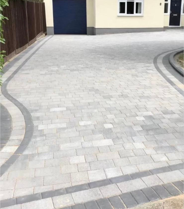
Broadstone's two guidance documents pull in opposite directions on driveways, and the answer is to do both. The 2009 appraisal describes shingle drives as informal and says they compliment the natural setting. The 2023 design guide asks that any surface adjacent to the highway be made up of bonded material, for example permeable block paving, and not loose material such as gravel, to avoid loose material spilling onto the road.
Read together, that gives you a workable drive: shingle or another informal permeable surface across the body of it where the appraisal wants that, and a bonded permeable margin at the highway edge where the design guide wants that. Pick one document, build to it, and you get told you ignored the other.
The hard rule sits underneath both. Paving over front gardens with non-permeable materials has not been allowed since October 2008, and above 5 square metres planning permission is needed for a traditional impermeable driveway. Permeable construction avoids the application, avoids the subsidence point the council itself makes about hard paving, and is the most direct thing a homeowner can do about a surface water problem the town measurably has.
The appraisal is blunt about what has gone in instead: tarmac and block paving has been used recently for large drives where shingle would be more appropriate. In the Ridgeway, Broadstone Park, Tudor Road and Golf Links Road areas, that sentence is aimed at your street. Our page on permeable driveways and patios covers the build-up, because permeable is a sub-base decision more than a surface one.
Which council
A BH18 address, and not necessarily a BCP one
A BH18 postcode does not tell you which council you are under, and this is the mistake we see most often on Broadstone jobs. BH18 straddles a local authority boundary. It covers the BCP wards of Broadstone, Canford Heath and Creekmoor, and it also covers Dorset Council's Corfe Mullen ward.
The clearest proof is a single postcode. BH18 9NQ, on Corfe Lodge Road, is a Broadstone postal address that sits legally in Corfe Mullen ward and parish, under Dorset Council. There are two parliamentary constituencies inside the outcode as well, Mid Dorset and North Poole, and Poole. Broadstone itself has its own post town, which makes the postal identity look tidier than the administrative one actually is.
This is not pedantry. Planning applications, building control, validation requirements and local design guidance all differ between the two authorities, and the conservation area rules described above are BCP's. If your address falls the Dorset Council side, a different set of documents applies to the same roof. We establish which before quoting anything needing consent.
Two other administrative points are worth having. Broadstone Town Council came into legal existence on 1 April 2026, with its first elections on 7 May 2026, following BCP's community governance review. Before that Broadstone was an unparished area, so anything you read saying the town has no council of its own is now out of date. And on nutrient neutrality, the Poole Harbour catchment boundary runs straight through Broadstone. The southern and eastern side towards Canford Heath is inside the catchment; the village centre and the north are outside it. We will not generalise about that, and neither should anyone else. It has to be checked for your specific address.
Setting
Heath at the end of the road, Scots pine over the gutter
Broadstone sits high and in heathland. The median elevation is around 53 metres above sea level, ranging from roughly 15 to 81, and BCP's LiDAR work puts the highest point at about 77 metres on the north and western edges. The Broadway is at 47 to 49 metres and Golf Links Road drops to 18 to 19.
The heath is closer than people assume. Broadstone Golf Course, whose club was founded in 1898, is inside a site of special scientific interest: the Corfe and Barrow Hills citation says the site includes the golf course because of the unusually large amount of heathland remaining there, across 102.8 hectares notified in 1986. Canford Heath is within a kilometre and Upton Heath within two, and Broadstone Heath local nature reserve adjoins the cricket ground.
That proximity brings a planning consequence anyone quoting you on an extension should raise rather than bury. Heathland mitigation applies within 400 metres of protected heath, and part of Broadstone sits inside that band. We will tell you the constraint exists. We will not tell you how it applies to a householder extension, because that is a judgement for the case officer.
The trees are the day-to-day version of the same story. The design guide records substantial colonisation by and planting of trees, mostly Scots pine, in the Dunyeats Hill area of large Arts and Crafts family houses in well-treed grounds, plus a landmark monkey puzzle at the local centre. Take the rest as our own observation rather than a sourced figure: mature pine over a shallow-pitched roof means gutters and valleys need looking at more often, and shaded north slopes hold moss for longer. That is a maintenance rhythm rather than a defect, and it is what roof and render cleaning is for.
What we do in Broadstone
Four trades, ordered by what Broadstone argues about
Ground surfacing comes first here, which it does on no other page on this site. Broadstone has the worst surface water record in Poole and a driveway rule that pulls two ways, so that is where the avoidable mistakes happen.
Driveways and patios
Permeable construction, shingle where the appraisal asks for it, bonded paving at the highway edge, and a build-up designed for clay rather than gravel. Over 5 square metres an impermeable surface needs permission, and any soakaway must sit 5 metres from the building.
Driveways and patiosRoofing
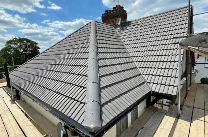
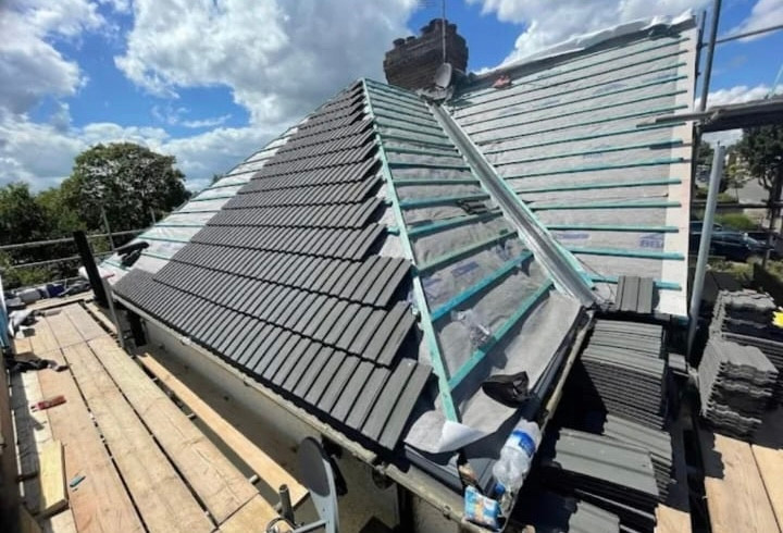
Two different jobs in one town. Plain clay tile, slate, chimneys, finials and leadwork inside the conservation areas, where like-for-like is the stated expectation. Low-pitched concrete interlocking tile on the post-war estates, where the covering is usually sound and the ridge, verge, underlay and flashings are not.
Roofs, repairs and re-coversBricklaying and repointing
Tuck-pointed orange brick and buff dressings that were burnt at Sharland's yard a few streets away, and Victorian cottages on Charborough Road already carrying cement pointing. Soft brick wants a soft mortar and a matched joint. The appraisal also asks that brickwork and boundary walls are not painted or rendered over.
Brickwork and repointingPlastering, rendering and insulation
Render is normal on the inter-war streets, white, cream and occasionally yellow, and contested on the Victorian brick. Mid-century houses here often have no chimney at all, which changes how a loft ventilates once it is topped up, so we look at the roof space before adding depth to it.
Plastering and renderingLoft and cavity work is priced alongside the roof rather than after it, and the insulation page covers what that involves. Otherwise, send us the address and a photograph and we will tell you what we think before anyone visits.
Questions
Questions we get in Broadstone
I have a BH18 postcode. Does that mean BCP handles my planning?
Not necessarily. BH18 straddles a council boundary. It covers the BCP wards of Broadstone, Canford Heath and Creekmoor, and it also covers Dorset Council's Corfe Mullen ward. BH18 9NQ, on Corfe Lodge Road, is a Broadstone postal address that sits legally in Corfe Mullen parish under Dorset Council. There are two parliamentary constituencies inside the outcode as well. Planning and building control differ, so we check the address rather than the postcode.
Can I put a soakaway in for a new driveway in Broadstone?
Often not straightforwardly. Every geological sample point in the built-up area is Poole Formation, with silty clay under the centre around The Broadway and Clarendon Road, and soft slope deposits called Head on Dunyeats Road, Wallace Road, Broadstone Heath and Pine Springs. Clay does not take infiltration well. BCP also requires any soakaway system to be at least 5 metres away from the building. We test the ground before designing the drainage rather than after.
Do I need permission to resurface my front driveway?
If the surface to be covered is more than 5 square metres and you are laying a traditional impermeable driveway, yes. Permeable construction avoids that, and paving front gardens with non-permeable materials has not been allowed since October 2008. Broadstone then adds a local wrinkle. The conservation area appraisal prefers informal shingle, while the 2023 design guide asks for bonded material next to the highway so loose gravel does not spill onto the road.
Can I fit a dormer or solar panels on a roof in the conservation areas?
Both need planning permission inside the Ridgeway and Broadstone Park or Tudor Road and Golf Links Road conservation areas. Dormer windows inserted into roof slopes are restricted, as are solar panels visible from the highway, cladding, and satellite dishes on walls, roofs or chimneys fronting a highway. Extension sizes are more restricted too. Outside those boundaries the ordinary permitted development rules apply, so the first question is which side of the line you are on.
There is no river here, so why does my street flood?
Because the water in Broadstone is surface run-off rather than river water. The neighbourhood plan records no coastal or river flood risk at all, and the built-up core is entirely flood zone 1. The 2011 preliminary assessment put 118 residential properties and 276 people at surface water risk in Broadstone ward, the highest residential count of any Poole ward. Recorded incidents include Lower Blandford Road on 22 January 2008 and Fairview Road on 12 July 2010.
Is my Victorian house in Broadstone a listed building?
Almost certainly not nationally. There is exactly one nationally listed structure in the Ridgeway and Broadstone Park conservation area, the Broadstone War Memorial in the recreation ground, sculpted by Gilbert William Bayes RA, dedicated in 1920 and listed in 2008. Everything else is locally listed or recorded as contributing to local character, including houses on Ridgeway, Charborough Road and Dunyeats Road. Local listing still shapes what the council will accept.
We cover The Broadway, Ridgeway and Broadstone Park, Tudor Road and Golf Links Road, Dunyeats Road and Dunyeats Hill, Charborough Road, Springdale Road, High Park Road, Roman Road, Clarendon Road, Upton Way and West Way, Lower Blandford Road, Moor Road, Kirkway, Laurel Drive, Sharlands Close, Wallace Road, Fairview Road, Pine Springs and the estates at Lytchett Drive, Sandford Way and Tadden Walk. Broadstone has its own post town, which is exactly why the council question comes first.
Trade by trade
Each trade, written for Broadstone
The same local evidence, read through each trade in turn. Ground conditions decide a driveway, exposure decides a roof, and the age of the housing decides insulation.
- Roofing in Broadstone
- Flat roofing in Broadstone
- Bricklaying and repointing in Broadstone
- Repointing in Broadstone
- Driveways and patios in Broadstone
- Patios in Broadstone
- Plastering and rendering in Broadstone
- Rendering in Broadstone
- Insulation in Broadstone
- Loft insulation in Broadstone
- Wall insulation in Broadstone
- Exterior cleaning in Broadstone
- Gutter cleaning in Broadstone
- Fascias, soffits and guttering in Broadstone
Who you are dealing with
A local firm you can check
Broadstone is on our regular run, from The Broadway and the Ridgeway down through Dunyeats Road, Clarendon Road and the estates off Upton Way. Give us the address rather than the BH18 postcode and we will tell you which council you are under.
You are dealing with Bournemouth Roofing & Building, the trading name of Bournemouth Roofing & Building Ltd, registered in England and Wales, company number 15471719. That takes a minute to check. Thomas Hannen owns the firm and he prices every job himself, so the person who quotes it is the person answerable for it. One multi-trade team does the work, and none of it is sub-contracted out to somebody you have never met.
There is a verified customer's 10 out of 10 on our Checkatrade profile. The site visit is free and so is the written itemised quote. The phone is answered 24 hours for emergencies, and scheduled work runs Monday to Friday, 8am to 6pm.
Free quote
Get a price for your Broadstone address
Give us the street and the full postcode. The postcode tells us which council you are under and the street tells us whether you are on the clay or on the Head. The quote is free and written, and it follows a site visit rather than a phone call.