
Roofers in Corfe Mullen
Roofing, brickwork and repointing, plastering and rendering, insulation, driveways and exterior cleaning across Corfe Mullen, from Mill Street and Brog Street up to Phelipps Road, Hilltop Road, Lambs Green and Corfe Lodge Road. Four bedrocks in one parish, and the ground changes what we can do to your house.
The site visit is free and so is the written itemised quote. Thomas Hannen prices every job himself.
Corfe Mullen
One name, two villages, and they never joined up
Corfe Mullen is not one settlement with a new bit on the end. It is two places that grew separately and still sit on different ground. The Christchurch and East Dorset Core Strategy, adopted in April 2014, puts it plainly at section 9.1: "The settlement has two distinct parts, with the old village in the north lying in the Stour Valley near the junction of the Blandford Road with the A31(T). The larger, more recent part of the village lies to the south along either side of the Wareham Road on a high plateau."
That is a planning sentence, but it is also a survey note. The two halves are about 45 metres apart vertically, and almost everything we get asked about here follows from which one you live in.
The old village around St Hubert's sits at roughly 33 metres above sea level at Mill Lane. Up on the plateau, Wimborne Road runs at 77 to 78 metres and The Knoll at 54 to 55. Across the parish the range runs from about 33 to 87 metres, a fall of roughly 50 metres from the southern ridge down to the Stour edge, and the water knows it.
The plateau is almost entirely a twentieth-century build. Population was 952 in 1921 and 10,374 at the 2021 census, across 4,296 households. It came in phases: interwar ribbon development along Higher Blandford Road and Wareham Road, then major estates around Phelipps Road and Hilltop Road in the 1950s and 1960s, then infill through the last forty years of the century until new housing covered most of the area between Broadstone and the eastern parish boundary.
None of that was the railway's doing. Corfe Mullen Halt on the Somerset and Dorset was a single platform with a shelter lit by one gas lamp, open from 27 June 1928 to 19 September 1956, and it did essentially nothing to the housing. The fabric here dates in blocks.
Ground
Four bedrocks under one parish, and five kinds of ground on top
Most places we work sit on one bedrock. Corfe Mullen spans four, with five different superficial deposits laid over them. British Geological Survey mapping at 1:50,000 scale, read at fourteen points across the village, gives clay in the north, sand in the south-west and river terrace gravels along the middle. That is the single biggest reason two identical-looking bungalows a few streets apart need different answers.
| Where | Bedrock | Deposit over it |
|---|---|---|
| Mill Street, St Hubert's, Court House | West Park Farm Member, clay, within the London Clay Formation | River Terrace 7 |
| Broadmoor Road | West Park Farm Member, clay | River Terrace 7 |
| Brog Street and Sleight Lane | West Park Farm Member, clay | None mapped |
| Higher Blandford Road, middle stretch | London Clay Formation | Head |
| The Knoll | Lytchett Matravers Sand Member | None mapped |
| Towers Way, north Wareham Road, Lambs Green, Phelipps Road, Hilltop Road | Poole Formation | River Terrace 13, sand and gravel |
| South Wareham Road and Naked Cross | Branksome Sand Formation, sand | River Terrace 13 |
| Cogdean Elms | Broadstone Clay Member | River Terrace 12 |
| East End | Poole Formation | Alluvium |
| Candys Lane | Poole Formation | River Terrace 12 |
The pattern is clear enough. The old village and the north-west corner sit on clay. The plateau and the south-west sit on sand and gravel. Somewhere between them, one gives way to the other, and that line is where the interesting problems live.
Drainage
Free-draining sand over impermeable clay: the rule that decides your soakaway
Water that sinks straight through the sand stops dead when it reaches the clay underneath, then travels sideways and comes out where the two meet. That is why a soakaway can pass a percolation test in one street here and fail 200 metres away, and it is not our opinion. It is written into a Natural England citation for a site named after the village.
Corfe Mullen Pastures SSSI was notified on 17 March 1994. It covers 11.64 hectares in a shallow valley between 40 and 65 metres above sea level to the west of the village. The citation explains why it is there: the site "straddles the boundary of the Poole Formation, consisting of sands and clays, and the underlying London Clay. The absence of drift has resulted in both geologies having a strong and contrasting influence." The grassland and mire communities are, in its words, "caused by local seepages and waterlogging where free draining sands overlie impermeable clay."
That is a nature conservation document describing a drainage mechanism: perched water on top of a clay layer, seepages breaking out at the geological boundary, and waterlogged ground next to ground that drains freely. It explains water in an excavation on a dry week, and a soakaway that works perfectly for two winters and then backs up.
The pattern is old news locally. The Royal Commission survey recorded that "the original village lay around the church of St Hubert's on a flat dry river terrace in the N.W. corner of the parish. Later settlements were established to the south and east on the Reading Beds and London Clay, e.g. Knoll and Sleight, which were both in existence by 1327." People were choosing the dry terrace over the clay seven hundred years ago.
So when we price a driveway, a patio or a soakaway here, the drainage design comes before the surface, and we will say so before you have chosen a block. The rest of how we approach hard surfacing and drainage is on the service page.
Water, and where it actually goes
The old village floods. The plateau above it does not.
"Corfe Mullen floods because it is on the Stour" is mostly wrong, and 99.8 per cent of the built-up area is in Flood Zone 1. Flood Zone 3 accounts for 0.14 per cent of the built-up area and Flood Zone 2 for 0.18 per cent, and both are essentially one finger of land roughly 45 metres by 200 metres at the north-west edge near Broadmoor Road and Haywards Lane, where the Stour floodplain reaches the settlement.
The river is not really a village feature at all. The Stour channel is 710 metres from the nearest built-up edge, and there are zero metres of Environment Agency Main River inside the built-up area. What the Stour actually is here is the parish boundary: of the parish's 17,360 metre perimeter, 3,616 metres has Main River running within 40 metres of it. The river defines the edge of the parish, not the middle of the village.
Where flooding is real, it is specific and it is recorded. The Core Strategy states at 9.4 that "the old village area on the A31(T) suffers from flooding." The Environment Agency's flood warning area for the Lower Stour from Sturminster Marshall to Christchurch names exactly one location in the whole parish: Mill Street in Corfe Mullen. Flood Zone 3 is present at Mill Street, Flood Zone 2 and 3 reach within 300 metres of St Hubert's, and Wareham Road and East End are both Flood Zone 1.
The other recorded problem is highway water, not river water. Dorset's Local Flood Risk Management Strategy technical report of August 2014 lists Broadmoor Road, Corfe Mullen as flooding three times between October 2013 and February 2014, one of only fifteen such roads in the county, and records nine property floods in the parish, one internal and eight external, between December 2013 and April 2014. It also notes that sewer flooding was known to be a problem here. No Section 19 flood investigation report exists for the village.
None of that means the plateau is dry. Perched water sits high on clay whether or not a river is anywhere near, and the highest ground in the parish can still have a wet garden. It means the cause is local geology rather than the Stour, and the fix is different.
Brog Street and Sleight Lane
Cob under thatch, and it is still standing
Corfe Mullen has a conservation area, whatever you may have read. The Brog Street and Sleight Lane Conservation Area was designated by East Dorset District Council on 31 October 2007 under SPG No. 30. It gets missed because the Core Strategy's settlement summary does not mention it, so a lot of sources state flatly that the village has none. It has one, and its materials are pre-industrial.
The appraisal's building materials section is worth quoting rather than paraphrasing: "The earliest vernacular buildings are built of local clay cob under thatched roofs. Some walls are rendered but others are faced in brick. Chimneys are in brick." The high cob wall on the west side of the triangle has "green sandstone rubble footings" and is "now capped with tile and ridge tile capping". Nineteenth century buildings are "brick, some faced in colour-washed render or stucco", and "roofs generally are of Welsh slate or plain clay tile." Most buildings keep their original timber windows.
Hart's Cottage is the one that surprises people. The appraisal calls it a rare surviving example of cob dating from the late sixteenth or early seventeenth century, with cob walls under a thatched roof extending as a cat-slide on the rear elevation, the west gable re-faced in brick in the nineteenth century, and Grade II listing. There is also a cob barn under thatch east of Glendon, and High Thatch, cob and thatch from the first half of the eighteenth century, faced in white-painted brick.
Around them: Glendon, a Regency mansion of about 1812 in course-lined stucco under a low-pitched hipped slate roof, Grade II. Coventry Lodge, early eighteenth century, four cottages knocked into one in 1848. Victoria Cottages in red brick and natural slate with buff brick quoins. Spring Cottage, rendered walls under a clay tiled gabled roof. Six buildings, six different roof coverings, on one small triangle of land.
Cob wants a breathable finish and a roof that keeps its feet dry. A cement render or a gypsum skim on a cob wall traps moisture in the wall and the wall goes soft. If you own one of these, tell us at the survey and we will price the lime option rather than the quick one. Our approach to render and internal plaster changes completely depending on what is behind it.
Layers
A Roman fortress, a school from 1706, and "Little Harlem"
A village that looks like 1960s bungalows from the main road has a deeper stack of history under it than almost anywhere else we cover. A Roman fortress was built at Lake Farm by the Second Legion under Vespasian around AD 70. A Roman road forms the eastern parish boundary. St Hubert's, the thirteenth-century parish church down on the terrace, is listed Grade II* under Historic England entry 1303916. Lockyer's Charity School was founded in 1706 and the buildings are still in use as Lockyer's Middle School.
Then there is 1942. African American troops were billeted in Corfe Mullen during the war, taking over large houses including Glendon and The Towers. Among them was the 1317th Engineer General Services Regiment, who built Tarrant Rushton aerodrome for D-Day. The village was known at the time as Little Harlem. There are wartime air-raid shelters recorded at Glendon and at Grooms Cottage.
In between, the village grew violets and lavender, centred on Violet Farm and Lavender Lodge, previously Corfe Lodge. Violet Farm was demolished in the 1960s, along with a 300-year-old tithe barn, to make way for bungalows. That is the shape of the whole village: something very old cleared for something very ordinary, and the two now on the same street.
Why it matters to us. You cannot read the age of a Corfe Mullen building from its neighbours. A rendered wall here can be cob, brick or blockwork, and the three want three different treatments. We take the covering and the wall build-up as questions to be answered on site, not assumptions to be made from the kerb. There are photographs of work we have completed across Dorset.
Admin traps
Which council, which rule, which catchment
A BH21 address is not automatically Dorset Council, and a BH18 address is not automatically BCP. Corfe Mullen is BH21 and Dorset Council. But BH21 straddles the authority boundary: it also covers Bearwood and Merley, which are BCP, and part of Broadstone ward. BH21 3AA, for example, is BCP Council in Bearwood and Merley ward. The outcode spans 25 parishes, two councils and three constituencies.
It runs the other way too. BH18 9NQ on Corfe Lodge Road is a BH18 postcode that sits in Dorset Council, in Corfe Mullen ward and parish. East Dorset's own appraisal describes Corfe Lodge Road as "separated from Corfe Mullen by Upton Heath", a low-density residential backwater "surrounded by heathland on the edge of an escarpment" with long views over Poole Harbour and the Purbeck Hills, mature Scots and Monterey pine and beech woodland managed by the Woodland Trust. It is Corfe Mullen, and its postcode says otherwise.
The other source of confusion is the post town. Letters go to Wimborne, so people assume the village belongs to Wimborne. Dorset Council's settlement hierarchy actually places Corfe Mullen, population estimated at 10,175, within the large built-up area of Bournemouth, Christchurch and Poole, as part of the conurbation rather than a freestanding village. The town council adopted town status on 10 December 2019.
Two designations decide what can be built. The village sits inside the South East Dorset Green Belt, which the Core Strategy says at 9.6 "has largely contained the settlement on the top of the plateau and has prevented development extending down the slopes to the north, west and south." And development is constrained by protected heathland: Corfe and Barrow Hills SSSI at 102.8 hectares and Corfe Mullen Pastures SSSI are both within about a kilometre, Upton Heath within two, Canford Heath within three. Under Dorset Heathlands Planning Framework policy ME2, no residential development is permitted within 400 metres of protected heathland, and anything between 400 metres and 5 kilometres provides mitigation. That bites on net new dwellings, so it is a question for an annexe or a plot, not for a re-roof.
One piece of good news. Corfe Mullen is outside every Natural England nutrient neutrality catchment. The Stour is not a designated catchment, so the nutrient mitigation problem that holds up new dwellings elsewhere in the county does not apply here.
What we do in Corfe Mullen
The trades this village needs, in the order the ground creates them
Drainage goes first here because it decides more jobs than the roof does. On sand over clay, the question of where the water ends up comes before the question of what the surface looks like.
Driveways and patios
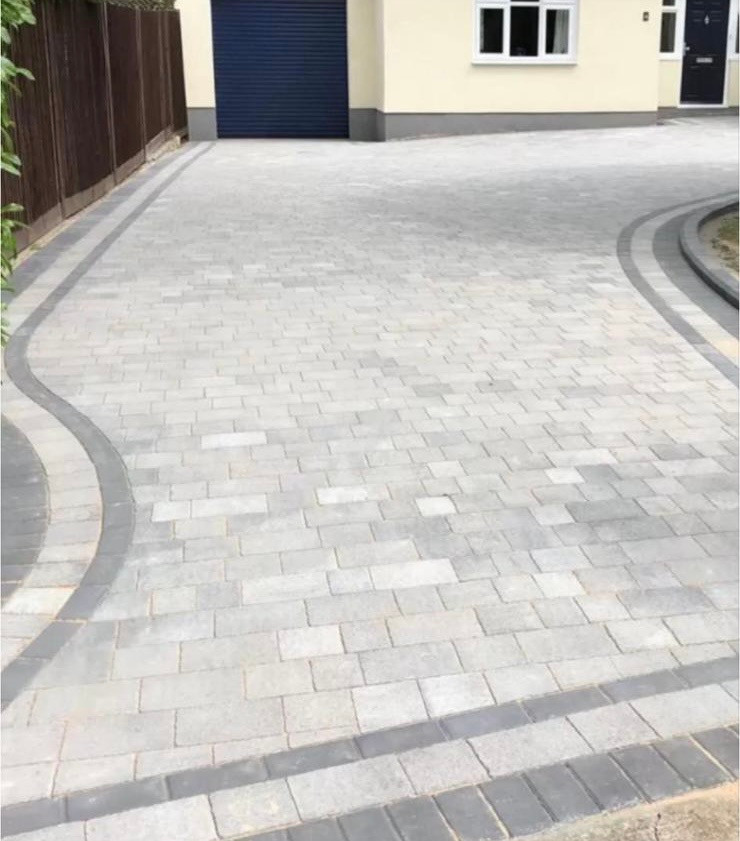
The perched water rule makes this the trade that goes wrong most often locally. A soakaway on the sand at Naked Cross or south Wareham Road behaves nothing like one on the West Park Farm clay at Brog Street or Broadmoor Road, and there is no borrowing the neighbour's result. We percolation test rather than guess, and with rainwater barred from the foul sewer the design has to stand on its own.
Driveways and patiosRoofing
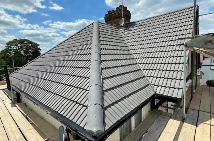
Two jobs again. In the conservation area it is Welsh slate, plain clay tile and thatch adjoining, where the covering is part of a protected frontage and substitution shows. On the plateau estates it is post-war and later concrete tile, where the tile is usually sound and the mortar bedding at ridge and verge, the felt at the eaves and the flashings are what have gone.
Roofing servicesBricklaying and repointing
Central Avenue is singled out in East Dorset's October 2005 guidance as a special character area of pre-war Edwardian-style houses with fine red brickwork, hipped roofs, tall chimneys, wide soffits and deep window reveals. The guidance asks for orange red facing brick and natural slate or plain tile, and asks that integral garages and dormers be avoided. Older walls here want lime, a matched joint and a raked joint, not a grinder.
Brickwork and repointingPlastering, rendering and insulation
The 2014 plan's housing figures, drawn from 2011-era data, record a third of homes in the parish as bungalows and only 6 per cent as flats. A bungalow has a large roof over a small footprint, so loft insulation and the state of the ceiling below it matter more here than in a town of terraces. On cob and older rendered walls, breathability decides the spec.
Loft and wall insulationWe also clean roofs, render and paving. One local observation rather than a sourced fact: the conservation area appraisal names oaks, chestnuts and ash, copper beech, yew and poplar, a specimen Monterey pine, a line of five Scots pine and a belt of aspen, and Corfe Lodge Road is ringed with more of the same. In our experience mature conifers and a heathland edge give gutters more to deal with than an open street does, and shaded slopes hold moss. Our roof and render cleaning page explains how we go about it without stripping the surface underneath.
Questions
Corfe Mullen questions we get asked
Is Corfe Mullen in Dorset Council or BCP?
Dorset Council, but the postcode will not tell you that. BH21 straddles the authority boundary: it also covers Bearwood and Merley in BCP and part of Broadstone ward, and spans 25 parishes, two councils and three constituencies. BH21 3AA is BCP. It works the other way too, because BH18 9NQ on Corfe Lodge Road is a BH18 postcode that sits in Dorset Council, in Corfe Mullen ward and parish.
Will a soakaway work for a new driveway in Corfe Mullen?
It depends which side of the geology you are on, and 200 metres can change the answer. Natural England's citation for Corfe Mullen Pastures SSSI describes local seepages and waterlogging where free draining sands overlie impermeable clay. Sand at Naked Cross drains, West Park Farm clay at Brog Street does not, and perched water sits on the boundary between them. We percolation test before we design, because a neighbour's working soakaway proves nothing about yours.
Does Corfe Mullen flood because it is on the River Stour?
Mostly no. 99.8 per cent of the built-up area is Flood Zone 1, the Stour channel is 710 metres from the nearest built-up edge, and there are zero metres of Main River inside the built-up area. The Stour is the parish boundary rather than a village feature. The recorded problems are the old village core, where the Environment Agency names Mill Street, and highway surface water on Broadmoor Road.
Does Corfe Mullen have a conservation area?
Yes, and a lot of sources say it does not. The Brog Street and Sleight Lane Conservation Area was designated by East Dorset District Council on 31 October 2007. Its appraisal describes local clay cob under thatched roofs, a high cob wall on green sandstone rubble footings, nineteenth-century brick with colour-washed render or stucco, and roofs generally of Welsh slate or plain clay tile. Hart's Cottage there is Grade II listed cob under thatch.
Do I need nutrient neutrality mitigation for an extension here?
No. Corfe Mullen sits outside every Natural England nutrient neutrality catchment, because the Stour is not designated. The rule that does bite locally is the heathland one. Policy ME2 of the Dorset Heathlands Planning Framework bars residential development within 400 metres of protected heathland and requires mitigation between 400 metres and 5 kilometres, and that applies to net new dwellings rather than to roofing or repair work.
My house is on Central Avenue. Does that limit what I can do to the roof?
It is likely to influence it. East Dorset's October 2005 guidance names Central Avenue as a special character area of pre-war Edwardian-style houses with hipped roofs, chimney stacks, wide soffits and fine red brickwork, and it is singled out as one of the few places where existing form and appearance exert a stronger influence over redevelopment. The stated materials are orange red facing brick with natural slate or plain tile roofs, avoiding dormers.
We cover the whole of Corfe Mullen: Mill Street, Court House, Brog Street, Sleight Lane, The Knoll, Higher Blandford Road, Central Avenue, Wareham Road, Naked Cross, Phelipps Road, Hilltop Road, Towers Way, Rectory Avenue, Candys Lane, Broadmoor Road, Haywards Lane, Lambs Green, East End, Cogdean Elms, Happy Bottom, Barrow Hill and Corfe Lodge Road, about seven and a half miles from Bournemouth. If you are not sure whether your address counts as Corfe Mullen, send us the postcode and we will tell you.
Trade by trade
Each trade, written for Corfe Mullen
The same local evidence, read through each trade in turn. Ground conditions decide a driveway, exposure decides a roof, and the age of the housing decides insulation.
- Roofing in Corfe Mullen
- Flat roofing in Corfe Mullen
- Bricklaying and repointing in Corfe Mullen
- Repointing in Corfe Mullen
- Driveways and patios in Corfe Mullen
- Patios in Corfe Mullen
- Plastering and rendering in Corfe Mullen
- Rendering in Corfe Mullen
- Insulation in Corfe Mullen
- Loft insulation in Corfe Mullen
- Wall insulation in Corfe Mullen
- Exterior cleaning in Corfe Mullen
- Gutter cleaning in Corfe Mullen
- Fascias, soffits and guttering in Corfe Mullen
Who you are dealing with
A local firm you can check
We work the whole of Corfe Mullen, from Mill Street and Brog Street across to Central Avenue, Cogdean Elms and Corfe Lodge Road. It is about seven and a half miles from us, so getting a van there is straightforward.
You are dealing with Bournemouth Roofing & Building, the trading name of Bournemouth Roofing & Building Ltd, registered in England and Wales, company number 15471719. That takes a minute to check. Thomas Hannen owns the firm and he prices every job himself, so the person who quotes it is the person answerable for it. One multi-trade team does the work, and none of it is sub-contracted out to somebody you have never met.
There is a verified customer's 10 out of 10 on our Checkatrade profile. The site visit is free and so is the written itemised quote. The phone is answered 24 hours for emergencies, and scheduled work runs Monday to Friday, 8am to 6pm.
Free quote
Get a price for your Corfe Mullen property
Tell us the street and what the building is doing. Quotes are free, and a written one follows a site visit rather than a phone call, because on this ground we would rather look at it than guess.