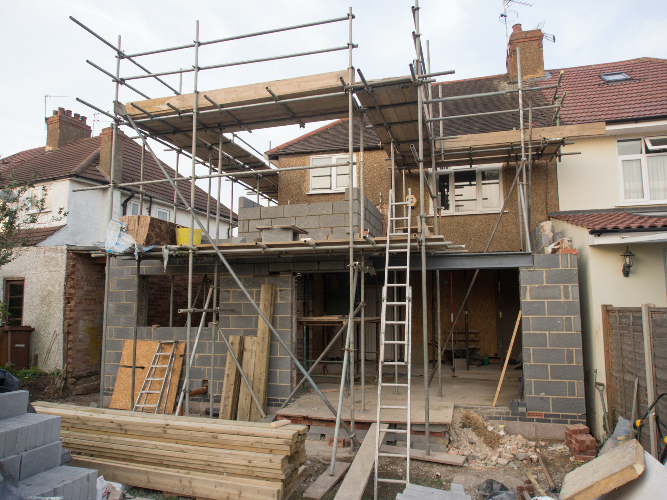
Highcliffe roofers and builders
Roofing, brickwork and repointing, plastering and rendering, insulation, driveways and exterior cleaning across Highcliffe, Highcliffe Castle, Friars Cliff, Steamer Point, Walkford, Nea Meadows and Chewton Bunny. A post-war town on an engineered cliff, facing due south into the bay that holds England's wind record.
The site visit is free and so is the written itemised quote. Thomas Hannen prices every job himself.
Highcliffe
Wind sets the specification here, not age
England's strongest recorded wind gust, 122 mph, was measured about 14 miles east south east of Highcliffe across Christchurch Bay. It was recorded at the Needles Old Battery on the Isle of Wight during Storm Eunice on 18 February 2022, breaking a record held at Gwennap Head in Cornwall since 15 December 1979. Highcliffe looks straight out at the water it crossed.
Aspect is the part people miss. The Shoreline Management Plan notes that this stretch is aligned to the south, rather than the more south westerly orientation of the Barton frontage two miles east.
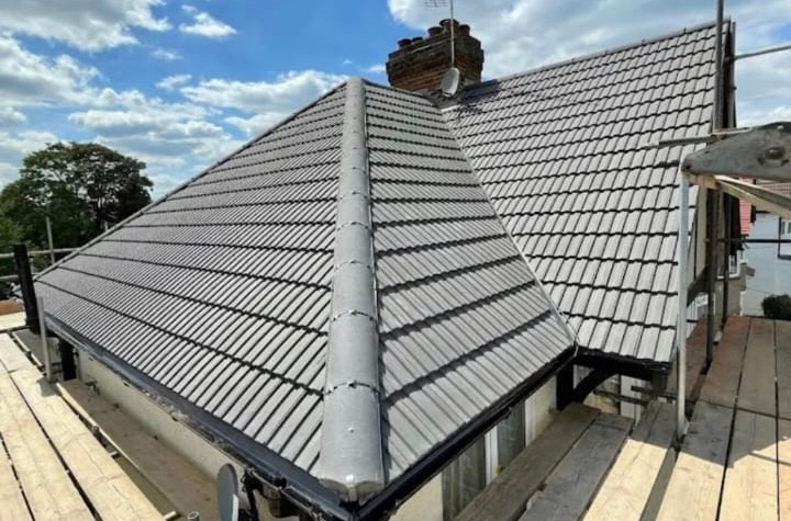
A due south frontage on an open bay is a different roof job from an inland one, and the British Standard has agreed since 2014. BS 5534 was revised that year and the wording is not gentle: it is no longer acceptable to have unfixed tiles on any roof. Every single lap tile is mechanically fixed. Every perimeter tile, meaning verges, abutments, valleys, hips, the first eaves course, the ridge and the edges around rooflights and chimneys, takes at least two fixings. Ridge and hip tiles are mechanically fixed even where they are also bedded in mortar.
What the standard does not do is hand you a single answer. The fixing schedule is worked out from the exposure of the actual site, so the same tile on the same pitch needs more fixings on a cliff top road than behind a shelter belt at Walkford.
Salt comes with that wind, and waves in the bay exceed one metre for 31 per cent of the time. Where fixings sit outside on a coastal roof they are worth specifying properly, which is why the NHBC asks for grade 316 stainless steel on coastal solar mounting brackets. We will not put a corrosion category number on your address, because nobody has measured one.
Repointing
A raked joint is a sheltered-site detail, and this is not a sheltered site
On an exposed elevation in Highcliffe the mortar joint should be tooled flush or bucket handle, not recessed or raked back. This has nothing to do with heritage or appearance. It comes out of the masonry exposure tables, so it applies to an ordinary 1960s bungalow exactly as it applies to anything else.
Those tables set a maximum exposure zone for a wall, and the joint profile moves it by two or three whole zones on the same build-up.
| Wall build-up | Joint tooled flush | Joint recessed |
|---|---|---|
| Built-in full fill insulation, 50 mm clear cavity | Zone 2 | Zone 1 |
| Built-in full fill insulation, 75 or 100 mm cavity | Zone 3 | Zone 1 |
| Partial fill, 50 mm residual cavity | Zone 3 | Zone 1 |
| Internal insulation, 100 mm clear cavity | Zone 4 | Zone 2 |
Read the right hand column. A recessed joint is a Zone 1 detail on three of those four build-ups, and Zone 1 is the most sheltered category that exists, because the recess gives wind driven rain a shelf to sit on. It photographs well. It is the wrong choice on a south facing wall here.
Two more numbers worth having before anyone starts
- Single leaf walls. A 100 mm single leaf wall left unrendered is not recommended in any exposure zone at all. Rendered, 100 mm is Zone 1, 215 mm reaches Zone 2 and 250 mm Zone 3. That bites on the garages, porches and outbuildings a bungalow plot comes with.
- Render over a full filled cavity. The NHBC standards do not permit render on an F2,S1 or F1,S1 clay brick outer leaf where the cavity is fully filled and exposure is severe or very severe. If you have been offered render on a wall cavity filled years ago, ask that before you pick a colour.
The housing stock
Four times the national share of bungalows, and the Census does not count them
36.1 per cent of the homes in the Highcliffe and Walkford ward are bungalows, 1,840 out of 5,100. The BCP average is 14.1 per cent and the England and Wales figure 9.1 per cent, so this is roughly four times the national rate. That comes from Valuation Office Agency council tax data rather than from the Census, because the Census does not record bungalows as a property type at all. Worth saying which source a number came from.
The rest of the mix is flats at 32.4 per cent, detached houses at 16.5 per cent and semis at only 5.3 per cent. The build era is as lopsided: 48 per cent of homes here date from the eighteen years between 1955 and 1972, against 19 per cent across England and Wales.
Now the number that decides how this page is written. Only 9.2 per cent of Highcliffe homes predate 1945, against 35.2 per cent nationally, and there is no conservation area anywhere in the parish. So the heritage answer, lime mortar and matched clay tile, is the wrong answer for most of this town. The right answer is exposure.
A bungalow also changes the arithmetic of a roof job. The whole floor area sits under one covering, so there is more roof, more verge and more guttering per household than on a two storey house of the same size. More to go wrong at the edges, and more to gain from getting the edges right.
Ground and water
Where your rainwater goes is a structural question, not a drainage one
The Highcliffe cliffs are moved by groundwater far more than by the sea. The Barton Clay here is impermeable, overconsolidated and fissured, and "contains lenses of sand, which supply groundwater to the cliff face and thus facilitate landsliding". Over the top sit Plateau Gravels of 1.5 to 7.6 metres, "creating strong seepage and gullying" where they meet the sandstones below.
BCP Council says the same in its own words: instability driven by the amount of groundwater and its movement through the layers of soil and rock, in cliffs that are over-steepened and poorly drained. On the Barton frontage next door, movement is observed when rainfall exceeds 80 mm in a month for two successive months.
That is why soakaways here are a live planning question rather than a formality. BCP's own Strategic Flood Risk Assessment records that the council's Cliff Asset Management System "may influence factors such as soakaways near the cliff top, so will be added to SFRA mapping once available". The council has flagged it and the mapping is still coming.
The ground decides the rest. Under the centre of Highcliffe the bedrock is Barton Clay Formation with River Terrace Deposits, sand and gravel, over it. Whether an infiltration system works depends on whether it bottoms in that gravel or reaches the clay underneath, and the only way to know is a BRE Digest 365 test on the plot. The group is classed as a secondary aquifer with variable infiltration potential, an honest way of saying it changes plot to plot.
And it changes over short distances. Friars Cliff is Boscombe Sand Formation, part of the Bracklesham Group rather than the Barton Clay it gets confused with, while Chewton Bunny and Walkford sit on Chama Sand. A test pit result from one end of town does not transfer to the other, so we price driveways and patios drainage after the test.
Flood Zone 1
Lowest flood zone there is, and it still flooded on 13 August 2020
Highcliffe is Flood Zone 1, the lowest category, at 57 of the 66 grid points tested across the settlement. Zone 3 appears only in a narrow tidal strip at the cliff toe and along the Bure and Walkford Brook corridors. BCP's assessment is explicit that the steep topography and high cliff line ensure the risk of sea flooding is low, and that coastal flooding to properties has not been an issue, because erosion is the concern instead.
None of which stops water getting into buildings. The same assessment records that the most significant historic flood events here are predominantly surface water events, and counts 121 surface water polygons at the one in thirty year event over the built-up area. Flood zones map rivers and the sea, not what a summer downpour does to a driveway falling towards a garage.
On 13 August 2020, Christchurch, Walkford and Highcliffe took 11.2 mm of rain in just over thirty minutes, an intensity rainfall radar put at a return period of one in 42 years. One residential property and several businesses flooded internally, and many more externally. That is the event to design against here, and it is a gutter, downpipe and surface levels problem rather than a sea defence one.
One related point, because it gets muddled. At Mudeford Quay the Environment Agency map says Zone 1 while council records show waves overtopping the quay wall annually. Both are true, because overtopping is not fully represented in the published zones.
The coastal policy people get wrong
Hold the line at Highcliffe. Managed realignment starts next door
Highcliffe to Friars Cliff is a hold the line frontage in all three Shoreline Management Plan epochs, 2025, 2055 and 2105. Managed realignment applies to Naish and Barton on Sea, the next frontages east. Those are BH25 postcodes in New Forest District, a different county and a different council, with Chewton Bunny as the boundary. The two get conflated constantly, and it changes what people believe about their own street.
What is actually in the ground is a stabilisation scheme: counterfort drains and vegetation planting on the cliff, rock armour and rock groynes at the toe, built in stages between 1970 and 1973 and again from 1985 to 1991. Friars Cliff itself is deliberately left undefended, which is a policy choice rather than neglect.
The zig zag path
Closed mid March 2017 for cliff movement, rebuilt, reopened 18 April 2019 at a cost of £884,500. It is a king post retaining wall incorporating drainage, designed around the geology of the site, on 77 steel king posts. Drainage, again, is the point of it.
£1.4 million, December 2025
BCP's Cabinet allocated £1.4 million to cliff stability on 1 December 2025. The council maintains over 700 sand drains and cliff drainage systems and named Highcliffe a priority drainage location. A Cliff Management Strategy is due March 2026.
The shelter that went
Mudeford Spit once ran across the harbour entrance as far as Highcliffe Castle, and while it did it also protected the sea cliffs behind. It breached in 1886, 1924 and finally 1935, and the Hengistbury long groyne of 1938 cut off the sediment feeding it.
We will not oversell any of that. The plan says plainly that if these defences were to fail in future, erosion of the cliffs would be expected to continue, and its figure of 363 properties at erosion risk over a hundred years comes from a do nothing modelling scenario rather than a forecast. Its headline rate of 1.1 metres a year describes erosion after defences fail, not conditions now.
One footnote. There is no Coastal Change Management Area at Highcliffe, and the Environment Agency action to define one is on hold, so anyone telling you your house sits in one is describing something that does not exist here. Our Roofers in Christchurch page covers the frontage west of Chewton Bunny, where conservation area rules change the answer.
How work gets decided here
Half the households are entirely people over 66. That changes the paperwork, not the job
50.6 per cent of households in the Highcliffe and Walkford ward, 2,461 of 4,866, consist entirely of people aged 66 and over. The England figure is 22 per cent. In the ward, 44.1 per cent of residents are 65 or over against 18.4 per cent for England, and 8.7 per cent are 85 or over against 2.4 per cent. Ranked against all 6,876 English wards, this one is 21st for the share aged 65 and over and 11th for the share aged 85 and over.
Tenure runs the same way. 82.3 per cent of homes are owner occupied and 59.1 per cent owned outright, against 32.5 per cent for England, with social renting at only 6 per cent. None of that is a reason to talk to anyone differently. It is a reason to work differently, in three ways.
- The decision is the owner's alone. With most of the town owned outright there is no lender, landlord or managing agent in the chain and no tenancy date forcing a start, so nothing needs deciding on a doorstep. We survey, quote in writing, and the price stays put while you think.
- Photographs, not adjectives. Nobody should have to climb a ladder to check that what they are being sold is real. Anything we say needs doing comes with a picture of it, and where a covering has years left we say so and quote the repair.
- A house held for decades is a sequence, not a single build. Sixty year old stock owned outright has usually had ridges rebedded, a flat roof recovered and a chimney taken down at different times by different people. Reading that sequence is how you find the thing that is failing.
One planning note. The Highcliffe and Walkford Neighbourhood Plan was made on 10 January 2023 after a referendum that passed with 86 per cent in favour, so it carries weight. The BCP Local Plan does not: it was withdrawn in June 2025 after a duty to cooperate failure and now carries no weight in decision making. That matters for an extension rather than a repair. You can see what we have been working on first if you like.
What we do in Highcliffe
The trades this town actually needs
Ordered by exposure, from the top down. The wind reaches the roof first, then the mortar joints, then the water once it is on the ground.
Roofing
A due south frontage on the bay that holds the England wind record puts fixings first. Mechanically fixed ridges and hips, two fixings on every perimeter tile, verge and eaves detailing that will not lift, and a schedule worked from the exposure of your address. A bungalow is a lot of perimeter for the floor area.
Roofing servicesBricklaying and repointing
The joint profile is the whole argument. Tooled flush or bucket handle on exposed elevations, because a recessed joint is a Zone 1 detail on most cavity build-ups. Plus weep holes at proper centres, a clear cavity, and attention to single skin garages and porches.
Brickwork and repointingDriveways and patios
Nowhere else we work does the drainage design matter this much. Near the cliff top the council has flagged soakaways as something its cliff asset mapping may influence, and the ground changes from gravel to clay to sand over a short distance. Infiltration test first, falls and outlet designed properly, surface chosen last.
Driveway and patio layingPlastering, rendering and insulation
Render is a real option on post-war stock, with the cavity fill question settled first. Insulation pays back well in a bungalow, because the loft covers the whole footprint, and 81.4 per cent of homes here run on mains gas only. Radon is not the complication it is elsewhere in Dorset, as Highcliffe sits in the lowest band.
Loft and wall insulationWe also handle internal plastering and skimming and roof, render and patio cleaning. That last one needs care on an exposed slope, because a pressure washer aimed at a mortar bedded ridge turns a cleaning job into a repointing job.
Questions
Highcliffe questions we get asked
Is Highcliffe in a conservation area?
No. There is no conservation area anywhere in the parish, which we checked against BCP's published list of 48, against the national dataset, and by testing points at the castle, the village centre, Friars Cliff and Walkford. Nor is there an Article 4 direction covering Highcliffe, as BCP has only two and both concern houses in multiple occupation. The nearest conservation areas are in Christchurch.
Is Highcliffe being given up to the sea?
No, and this is the most common misunderstanding we hear. Highcliffe to Friars Cliff is designated hold the line in all three Shoreline Management Plan epochs, 2025, 2055 and 2105. Managed realignment applies to Naish and Barton on Sea, the next frontages east, in New Forest District rather than BCP. BCP allocated £1.4 million to cliff stability on 1 December 2025.
Can I put in a soakaway near the cliff top?
Possibly, but it needs testing and it is on the council's radar. BCP's flood risk assessment records that its Cliff Asset Management System may influence factors such as soakaways near the cliff top. The ground is Barton Clay bedrock with sand and gravel terrace deposits over it, so infiltration depends on what the pit bottoms into. A BRE Digest 365 test answers that.
Should my repointing be raked back for a neater look?
Not on an exposed elevation here. The masonry exposure tables treat a recessed or raked joint as a Zone 1 detail on most cavity build-ups, and Zone 1 is the most sheltered category there is. The same wall tooled flush is rated for Zone 2 or Zone 3, because a recess gives wind driven rain somewhere to sit.
My bungalow ridge is bedded in mortar only. Is that a problem?
It is not unlawful, but it is not what current practice asks for. BS 5534 was revised in 2014 and states that it is no longer acceptable to have unfixed tiles on any roof: ridge and hip tiles must be mechanically fixed even where they are also bedded in mortar. On a due south frontage in this bay, the ridge and verges are what we inspect first.
If Highcliffe is Flood Zone 1, why did water come across my drive?
Because flood zones map rivers and the sea, not rainfall. Highcliffe is Zone 1 at 57 of 66 grid points and the cliff line keeps sea flooding risk low, but its most significant historic flood events have been surface water events, with 121 polygons mapped at the one in thirty year event. On 13 August 2020, Christchurch, Walkford and Highcliffe took 11.2 mm in half an hour, a one in 42 year intensity.
We cover Highcliffe, Highcliffe Castle, Highcliffe Beach, Friars Cliff, Steamer Point, Walkford, Nea Meadows, Chewton Bunny and Mudeford Quay, across BH23 4 and BH23 5. Highcliffe has come under BCP Council since 1 April 2019. The BH23 outcode spans three authorities and eight wards, so the postcode alone does not tell you which council you are dealing with, and Chewton Bunny is the Dorset and Hampshire boundary.
Trade by trade
Each trade, written for Highcliffe
The same local evidence, read through each trade in turn. Ground conditions decide a driveway, exposure decides a roof, and the age of the housing decides insulation.
- Roofing in Highcliffe
- Flat roofing in Highcliffe
- Bricklaying and repointing in Highcliffe
- Repointing in Highcliffe
- Driveways and patios in Highcliffe
- Patios in Highcliffe
- Plastering and rendering in Highcliffe
- Rendering in Highcliffe
- Insulation in Highcliffe
- Loft insulation in Highcliffe
- Wall insulation in Highcliffe
- Exterior cleaning in Highcliffe
- Gutter cleaning in Highcliffe
- Fascias, soffits and guttering in Highcliffe
Who you are dealing with
A local firm you can check
We cover Highcliffe, Walkford, Friars Cliff, Steamer Point, Nea Meadows and Chewton Bunny, across BH23 4 and BH23 5. Tell us the street and we will tell you which of the three authorities in that outcode you are dealing with.
You are dealing with Bournemouth Roofing & Building, the trading name of Bournemouth Roofing & Building Ltd, registered in England and Wales, company number 15471719. That takes a minute to check. Thomas Hannen owns the firm and he prices every job himself, so the person who quotes it is the person answerable for it. One multi-trade team does the work, and none of it is sub-contracted out to somebody you have never met.
There is a verified customer's 10 out of 10 on our Checkatrade profile. The site visit is free and so is the written itemised quote. The phone is answered 24 hours for emergencies, and scheduled work runs Monday to Friday, 8am to 6pm.

Free quote
Get a price for your Highcliffe property
Tell us the road and which way the worst elevation faces. If you are near the cliff top or you are asking about drainage, say so, and we will price the version that suits the exposure rather than the cheapest one.